


Boulder 156, Boulder County, Colorado
About
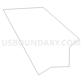
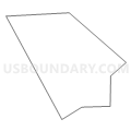
Outline
Summary
| Unique Area Identifier | 547010 |
| Name | Boulder 156 |
| County | Boulder County |
| State | Colorado |
| Area (square miles) | 0.17 |
| Land Area (square miles) | 0.17 |
| Water Area (square miles) | 0.00 |
| % of Land Area | 100.00 |
| % of Water Area | 0.00 |
| Latitude of the Internal Point | 39.99694430 |
| Longtitude of the Internal Point | -105.25807900 |
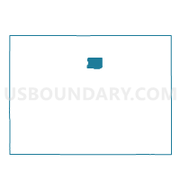
Maps

Graphs
Select a template below for downloading or customizing gragh for Boulder 156, Boulder County, Colorado


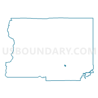
Neighbors
Neighoring Voting District (by Name) Neighboring Voting District on the Map
- Boulder 103, Boulder County, CO
- Boulder 106, Boulder County, CO
- Boulder 118, Boulder County, CO
- Boulder 153, Boulder County, CO
- Boulder 155, Boulder County, CO
- Boulder 157, Boulder County, CO
- Boulder 158, Boulder County, CO
Top 10 Neighboring County Subdivision (by Population) Neighboring County Subdivision on the Map
Top 10 Neighboring Place (by Population) Neighboring Place on the Map
Top 10 Neighboring Unified School District (by Population) Neighboring Unified School District on the Map
Top 10 Neighboring State Legislative District Lower Chamber (by Population) Neighboring State Legislative District Lower Chamber on the Map
Top 10 Neighboring State Legislative District Upper Chamber (by Population) Neighboring State Legislative District Upper Chamber on the Map
Top 10 Neighboring 111th Congressional District (by Population) Neighboring 111th Congressional District on the Map
Top 10 Neighboring Census Tract (by Population) Neighboring Census Tract on the Map
- Census Tract 125.11, Boulder County, CO (6,265)
- Census Tract 123, Boulder County, CO (6,196)
- Census Tract 124.01, Boulder County, CO (5,699)
- Census Tract 126.07, Boulder County, CO (4,258)
- Census Tract 125.07, Boulder County, CO (4,202)
- Census Tract 125.05, Boulder County, CO (4,102)